
Walk a Spanish Fork Street
A useful street directory search moves from location to identity and then back to source documents. The address is a starting point, not a conclusion. Utah County’s map can locate the parcel, the assessor can show the owner index row, and the recorder can show the instrument behind a transfer or easement. Voter information is a separate registration record. Printed directories may add an older household clue, but they do not turn a name into proof of present occupancy.
Use this order for a clean address trail:
- Enter the address in the Utah County Parcel Map, accept the autocomplete result, and note the parcel serial, subdivision, plat or lot, and site address.
- Open the county assessor search and compare the owner, tax area, validity years, property address, and mailing fields.
- Use the county recorder’s name, serial, entry, document, or description search for the deed chain and related instruments.
- Check the Utah voter self-lookup only for an individual’s own registration or use the county elections route for a lawful data request.
- For an older household, ask the library or archive for a reverse directory, printed directory, newspaper, or property file and tie the page back to the parcel.
Utah County Parcel Search Fields
The county viewer offers more than one way to reach a Spanish Fork parcel. Address or common-place-name autocomplete is the natural street route. Serial or book-page search helps when a legal document gives a reference but the street spelling is unclear. Owner-name search accepts partial or full names, while PLSS section and city searches help with land that predates a familiar address.
| Address | Autocomplete for a street location; tips allow common forms such as Blvd, St, Wy, and N, E, S, or W. |
|---|---|
| Serial | Accepted as 123456789, 12:345:6789, 12 345 6789, or 12-345-6789; multiple serials may be comma-separated. |
| Owner | Partial or full name; select the match and use Zoom to when several parcels appear. |
| PLSS | Section, township, and range reference, with an example of 33 5 3E in the research capture. |
| City | A city filter for geographic context, not a substitute for boundary or legal-description review. |
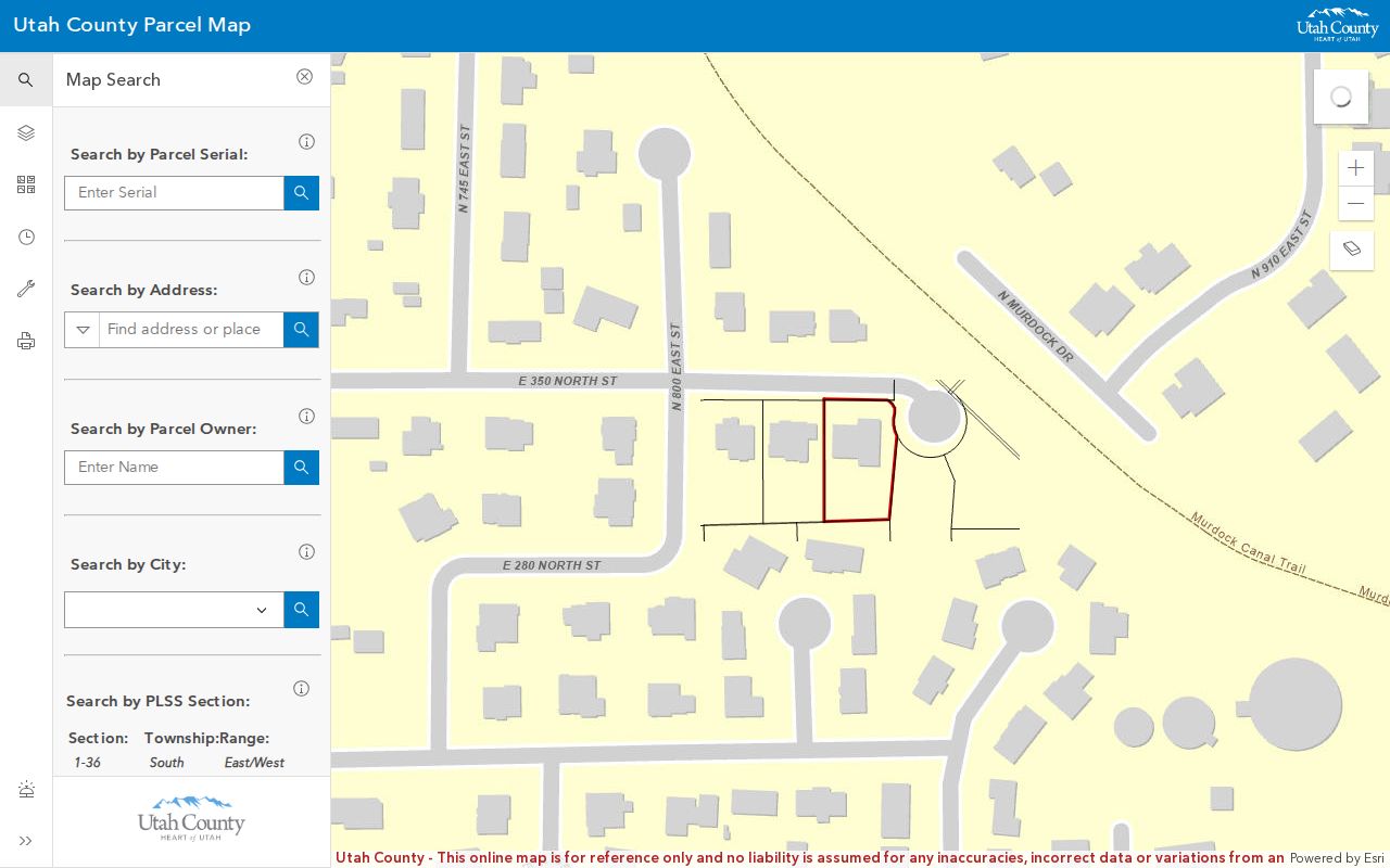
The viewer also has parcel layers, aerial basemaps, measurement and coordinate tools, deed points, a historic parcel date picker, and map export. The historic date is the parcel’s entry in the online system. It is not a deed recording date.
Address Records Along a Street
Several Utah County and Spanish Fork sources can be read by address, but each answers a different question. The coverage table keeps those roles distinct. A property row can identify an owner of record. A deed can identify parties to an instrument. A permit can show that a request was filed. A voter record concerns registration and may be withheld. No one row is a complete household list.
| Record Set | Keeper | Address Value | Access |
|---|---|---|---|
| Property and tax index | Utah County Assessor | Owner, parcel serial, tax area, site and mailing clues | Web search |
| Parcel GIS | Utah County GIS | Boundaries, dimensions, address points, adjacent parcels | Free viewer and map tools |
| Recorded documents | Utah County Recorder | Principal parties, legal description, sale or easement record | Index, images, counter, mail |
| Voter records | Utah Elections | Registration data within public-file rules | Self-check or lawful request |
| Permits and planning | Spanish Fork Community Development | Permit category or planning file tied to an address or parcel | CitizenServe or GRAMA |
The serial is the best bridge among the first three rows. Keep the street name and house number as a readable clue, but use the legal description when an old record does not line up.
Situs and Mailing ZIPs Differ
Utah County parcel metadata names two address ideas that are easy to mix up. SITE_STREET_NAME, SITE_STREET_TYPE, SITE_POST_DIR, SITE_STREET_UNIT, SITE_CITY, SITE_STATE, and SITE_ZIP5 describe the property location. OWN_FULL_ADDRESS, OWN_STREET_ADDRESS, OWN_CITY, OWN_STATE, and OWN_ZIP5 describe the owner’s mailing address. A Spanish Fork street directory should never silently substitute one for the other.
This distinction matters when a property is owned by an organization, when mail goes to another city, or when a historic directory uses a different place label. Copy both fields when they appear. Then compare them with the parcel map, recorder legal description, and any permit or planning record. A ZIP can help sort the result, but it does not prove municipal placement.
Practical tip. Write “situs,” “mailing,” “owner,” or “party” beside every address in your notes. That one label prevents a map clue from becoming an unsupported residence claim.
Street Maps Have a Time Layer
Spanish Fork’s street pattern also has a documented historical wrinkle. The February 2005 city newsletter says Main Street was first planned at 300 East and later moved west because of the railroad. It dates Main Street paving to August 1920. A directory, Sanborn map, plat, and present GIS layer can therefore place a familiar street name in different physical contexts.
The city annexation record lists an earliest boundary in 1872, large de-annexations in 1899 and 1904, smaller annexations in 1952, 1961, and 1964, later expansion in the late 1960s and 1970s, and a 2007 map for the current boundary. No formal Spanish Fork street-renumbering schedule was located. When a number seems wrong, compare the legal description, parcel serial, subdivision plat, historic map, and recorder abstract.
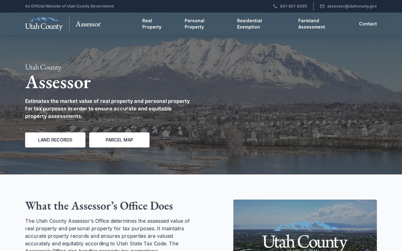
The Utah County Assessor search is the street-to-parcel starting point.
After the assessor row is saved, compare the parcel shape and map layers before interpreting the older street clue.
The Utah County Parcel Map supplies the historic-date and layer view.
Recorder Searches by Address
The Utah County Recorder says official records run from 1870 to the present in books, microfilm, or scanned images. The alphabetical index is handwritten from 1870 through January 1978 and computerized from January 1978 forward. Abstract records are handwritten or typed through September 1985, with computerized or online material beginning in May 1980. The overlap is useful when a search crosses the change in index form.
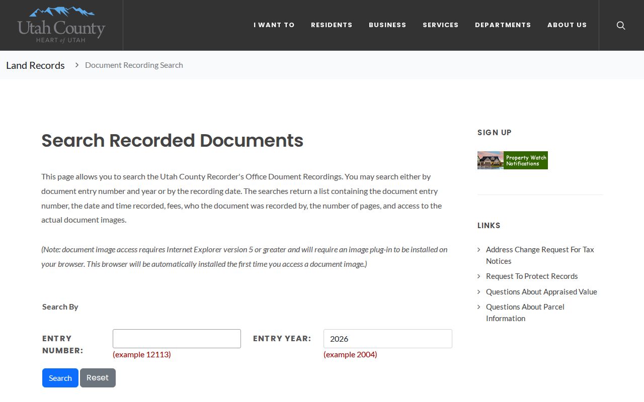
Recording search fields are Entry Number, Entry Year, Start Date, and End Date, with dates in MM/DD/YYYY format. Other forms search an entry number and year, book and page, serial and entry, or city, plat, block, and lot. The document-description page warns that a taxing description is not for legal documents. Results may show entry number, recording time, fees, recorder, page count, and image. Staff do not perform title searches.
Open the Utah County recording search to see the entry and date-range route that supports street research.
Permits Add a City Layer
Spanish Fork Community Development sends permit applications through CitizenServe. The listed categories include new buildings, accessory structures, additions, renovations, electrical, plumbing, HVAC, signs, and fences. The office is at 40 S Main, Room 120, Spanish Fork, and lists 801-804-4540. Permit presence alone does not prove completion, occupancy, ownership, or code compliance.
The public crawl did not expose a complete permit search field list, historical migration range, status definitions, or fee table. Ask for a narrow address, parcel or permit number, date range, and document type through the portal, Community Development, or a written city GRAMA request. Pair any permit number with the county serial and city parcel or zoning layer.
Spanish Fork’s downloadable GIS layers are updated nightly and include boundaries, addresses, buildings, final and preliminary plats, property lines, zoning, growth boundaries, public facilities, schools, churches, parks, and utility layers. The city states data-use limits and disclaims warranties, so cite the layer date.
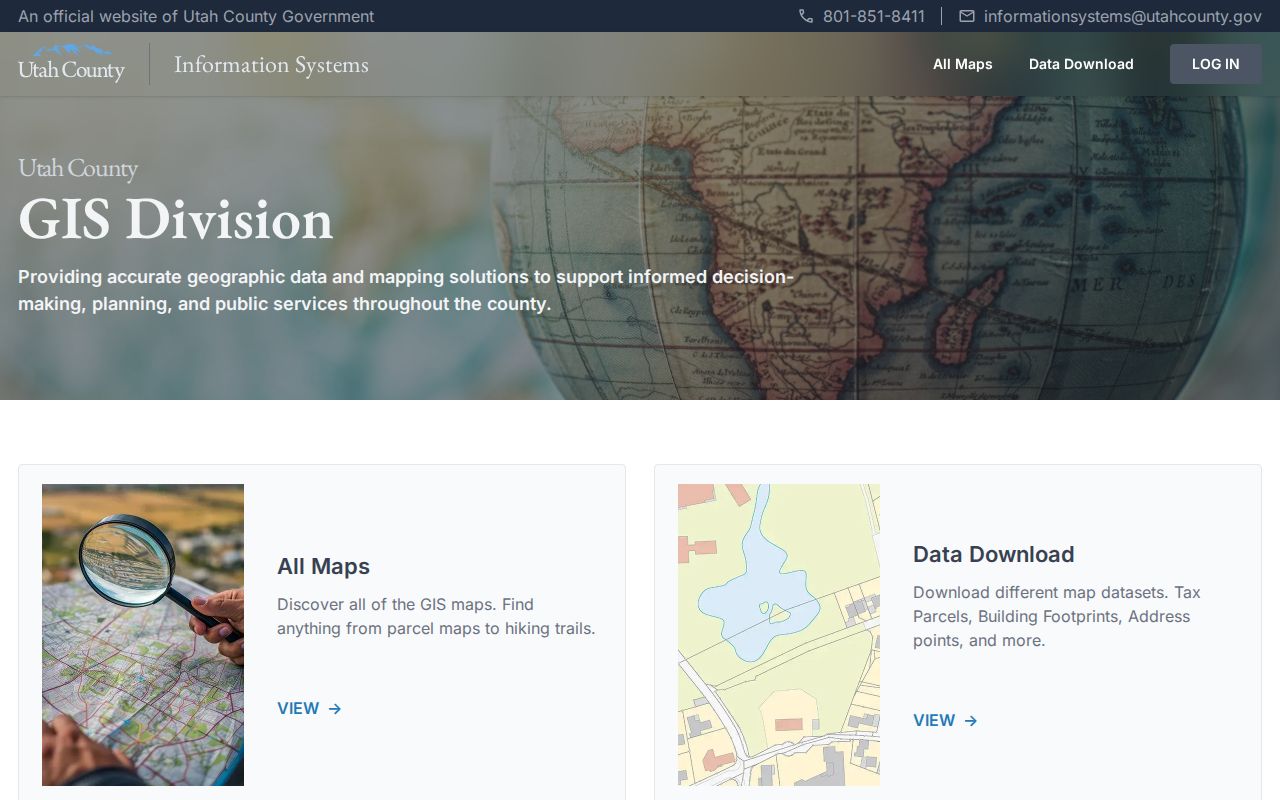
The Utah County GIS hub inventories parcel, address, road, zoning, and infrastructure tools.
Reverse Directories Need Care
A criss-cross directory starts with an address and points toward a printed name or household entry. The located regional directory evidence is the R.L. Polk Provo City and Utah County scan, which has a Spanish Fork section on pages 241 through 252. The University of Utah city-directory collection describes books arranged by residents, streets, businesses, organizations, and institutions. The exact continuous Spanish Fork run and full reverse-directory shelf are not confirmed.
Ask Spanish Fork Library staff about directories, yearbooks, clippings, photographs, and oral-history material. The library is at 80 S Main and publishes hours Monday through Thursday 9 a.m. to 8 p.m., Friday 9 a.m. to 6 p.m., and Saturday 10 a.m. to 5 p.m. A regional or archive entry can show a printed address in a given year, but it does not establish the current owner or occupant.
Parcel Terms Made Plain
Four terms recur in an address-led search:
- Parcel
- A mapped land unit identified by a county serial and legal description.
- Situs address
- The physical location of the parcel, distinct from the owner’s mailing address.
- Plat
- A recorded map that lays out lots, blocks, streets, or divisions.
- Criss-cross directory
- A reverse address-to-name reference, usually a printed historical source.
- Legal description
- The formal land description used in a recorded instrument; it is stronger than a casual street label for reconciliation.
Use the parcel serial and legal description when a street search crosses an annexation, subdivision, railroad alignment, or possible number change. Then retain the source and date beside the conclusion.
What the Street Directory Cannot Show
A street search cannot create a public list of every person inside each building. Utah voter information has private fields and at-risk protections. Driver records are limited by the federal Driver’s Privacy Protection Act. Utility customer information is not a general public household index. A property owner may receive mail elsewhere, and a printed directory may reflect only the publication year.
For current records, state the exact relation shown: owner, party, registrant, permit record, or address point. For historical work, state whether the item is a directory entry, deed, tax roll, map, obituary, or newspaper reference. If access is denied, the reason may be classification, a sealed record, a missing image, a spelling variant, or a coverage gap. Do not claim more than the custodian’s record says.
Lawful use. Use Spanish Fork address records for personal, civic, legal, property, or family-history research. Do not use them to stalk, harass, intimidate, expose a protected address, or repeatedly contact a person.